What Causes Hurricanes? 5 Simple Ingredients, Explained by Hurricane Isaias
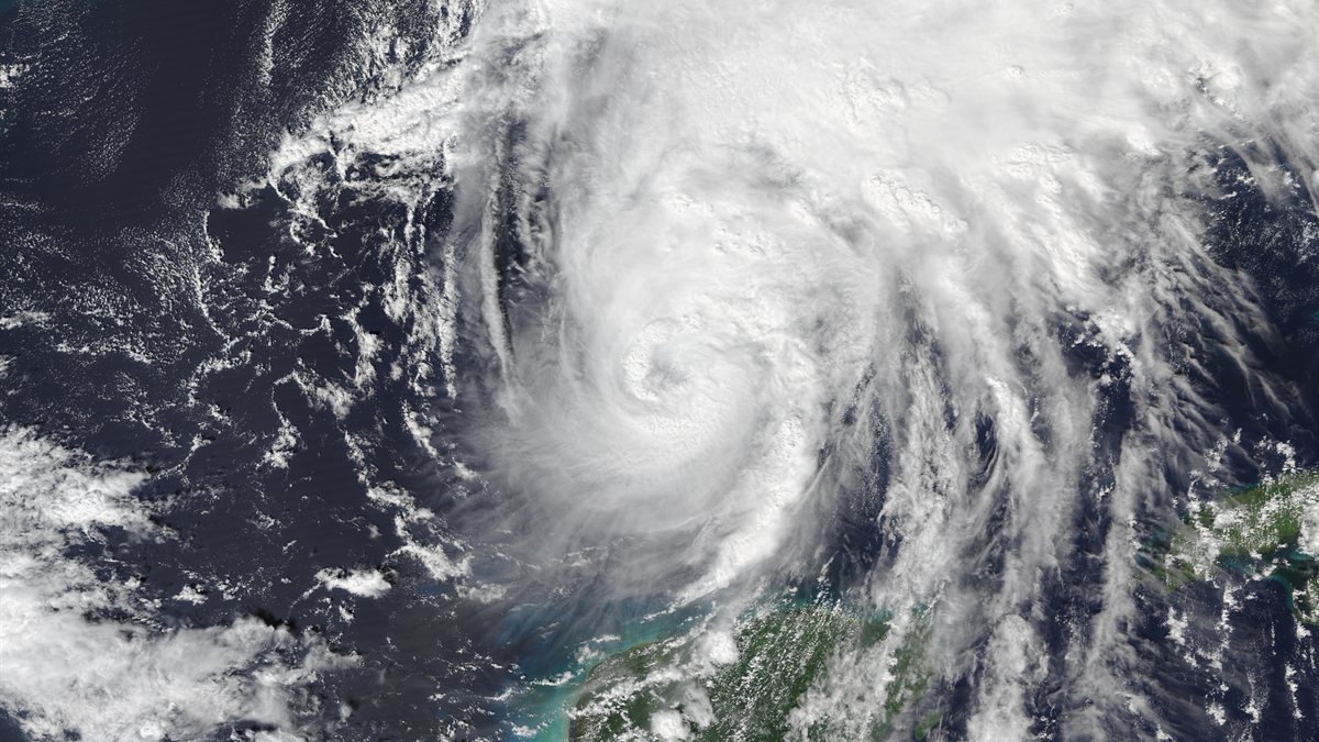
Right now, as you read this, a giant spinning storm called Hurricane Isaias (say it "ees-ah-EE-ahs") is moving across the Gulf of Mexico towards the southern coast of the United States. From space it looks almost peaceful, like milk swirled into a cup of tea. Up close it means roaring wind, sideways rain and sea water pushed onto land.
So where does a storm like this actually come from? Does it just appear? The good news is that the answer is simpler than you might think. A hurricane is like a recipe. It needs five ingredients, and when they all come together at the same time, the ocean builds a storm.
First, what exactly is a hurricane?
A hurricane is a huge, spinning storm that forms over warm tropical seas. It has winds of at least 119 km/h (74 mph), which is faster than a car on the highway. It can be hundreds of kilometres wide.
The same kind of storm has different names in different parts of the world:
- Hurricane in the Atlantic Ocean and north-east Pacific (near America)
- Typhoon in the north-west Pacific (near Japan, China and the Philippines)
- Cyclone in the Indian Ocean and South Pacific, which includes our own East African coast
The 5 ingredients that create a hurricane
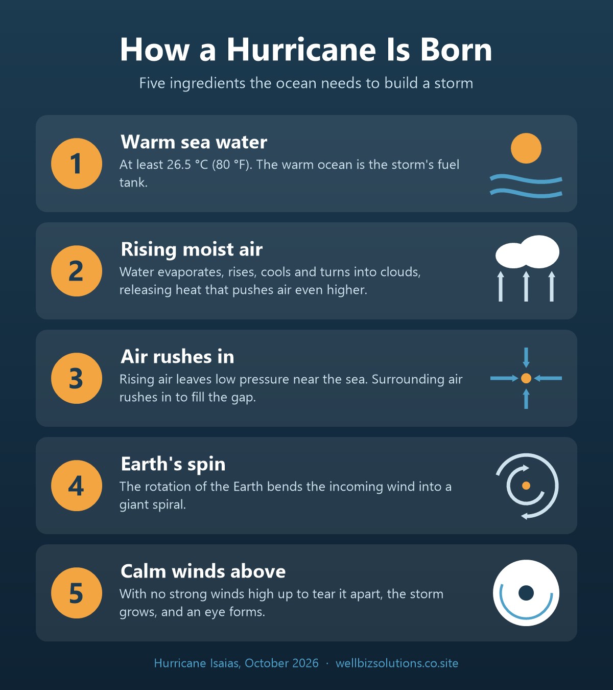
1. Warm sea water: the fuel
Hurricanes only form over ocean water that is at least 26.5 °C (80 °F), about as warm as a nice bath that has started to cool. The warmth also has to go deep, not just sit on the surface. Think of the warm ocean as the storm's fuel tank. No warm water, no hurricane.
2. Warm, wet air rises: the engine
The sun heats the sea, and water evaporates into the air as invisible vapour. Warm, wet air is light, so it rises. As it goes higher it cools, and the vapour turns back into water droplets, which is how clouds form.
Here is the clever part. When vapour turns into cloud, it gives off heat. That heat warms the air around it, so the air rises even faster. This is the storm's engine, and it keeps feeding itself.
3. Air rushes in to fill the gap
When so much air rises, it leaves an area of low pressure near the sea surface. You can picture it as an "empty space". Air from all around rushes in to fill that space, and that rushing air is the wind.
4. The Earth's spin makes it twist
Our planet is always spinning. Because of this, wind that rushes towards the centre gets bent sideways instead of travelling straight. The result is a giant spiral, like water swirling down a sink. North of the equator, hurricanes spin anticlockwise. South of the equator, cyclones spin clockwise.
Fun fact: right on the equator the Earth's spin has almost no twisting effect. That's why these storms almost never form within about 500 km of the equator.
5. Calm winds high above: room to grow
The last ingredient is about what is not there. If strong winds are blowing high up in the sky, they tilt the storm and tear its top off before it can grow. Hurricanes need the winds up high to be fairly calm, so the storm can stand straight like a chimney.
When all five ingredients line up, the storm grows stronger. A calm, clear hole called the eye forms in the middle. It is surrounded by the eyewall, a ring of the most violent wind and rain in the whole storm.
How a hurricane grows, step by step
Weather scientists give the storm a new name at each stage as it gets stronger:
| Stage | Wind speed | What it means |
|---|---|---|
| Tropical disturbance | Light | A cluster of thunderstorms over warm water |
| Tropical depression | Up to 62 km/h | The clouds start to spin around a centre |
| Tropical storm | 63–118 km/h | It gets a name, like "Isaias" |
| Hurricane | 119 km/h and above | Rated Category 1 (weakest) to Category 5 (strongest) |
Hurricane Isaias 2026: the recipe in real life
Hurricane Isaias shows every ingredient at work. It grew from an area of low pressure over the very warm waters of the south-western Gulf of Mexico and became a named tropical storm on 6 October 2026. On 8 October it became a hurricane, and later a Category 2 storm. Early on 9 October, the US National Hurricane Center measured its winds at about 165 km/h (105 mph).
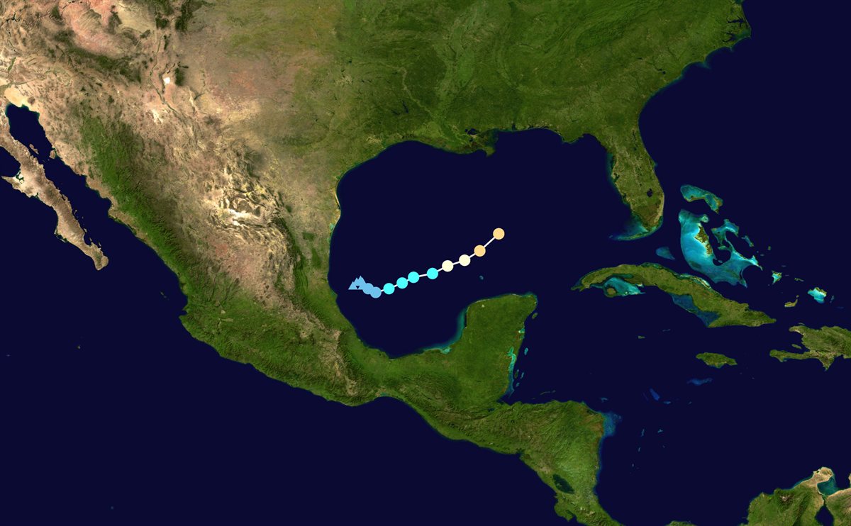
Isaias also made history. It is the first hurricane of the whole 2026 Atlantic season, and it arrived in October. That is the latest a first hurricane has formed in more than 120 years of records. This is a good lesson: warm water alone is not enough. For most of this season, the five ingredients simply did not line up at the same time.
Forecasters expected Isaias to come ashore on the evening of Friday 9 October, somewhere between Dauphin Island in Alabama and Destin in Florida. They warned of storm surge (sea water pushed onto land) of up to about 2 metres and up to 380 mm of rain in places. Thousands of people were ordered to leave the coast. Oil companies shut down more than half of the oil production in the Gulf as a precaution.
Note: Isaias was still an active storm when we wrote this article on 9 October 2026. For the latest updates, follow the US National Hurricane Center.
Wait, wasn't there a Hurricane Isaias before?
Yes! Atlantic storm names come from six lists that are reused in turn, so the same names return every six years. A name is only "retired" if the storm was especially deadly or destructive. The 2020 list came back this year, and that is why we have a second Isaias.
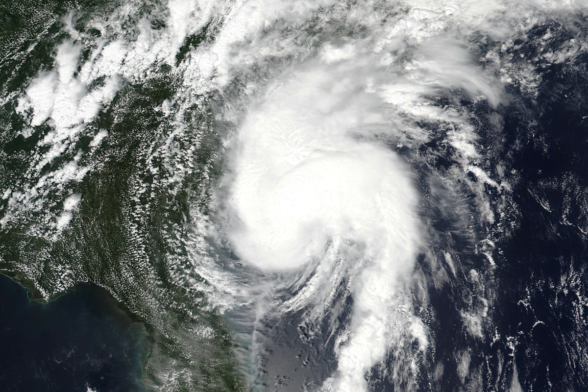
The first Isaias, in 2020, was a Category 1 hurricane. It formed in late July, crossed Puerto Rico and the Bahamas, and came ashore near Ocean Isle Beach, North Carolina, on the night of 3 August 2020 with winds of about 150 km/h (90 mph). Here is what it did:
- It caused 39 tornadoes along the US East Coast. One of them, near Windsor in North Carolina, killed two people.
- More than 2.7 million homes and businesses lost electricity.
- About 17 people died and damage reached roughly US$5 billion.
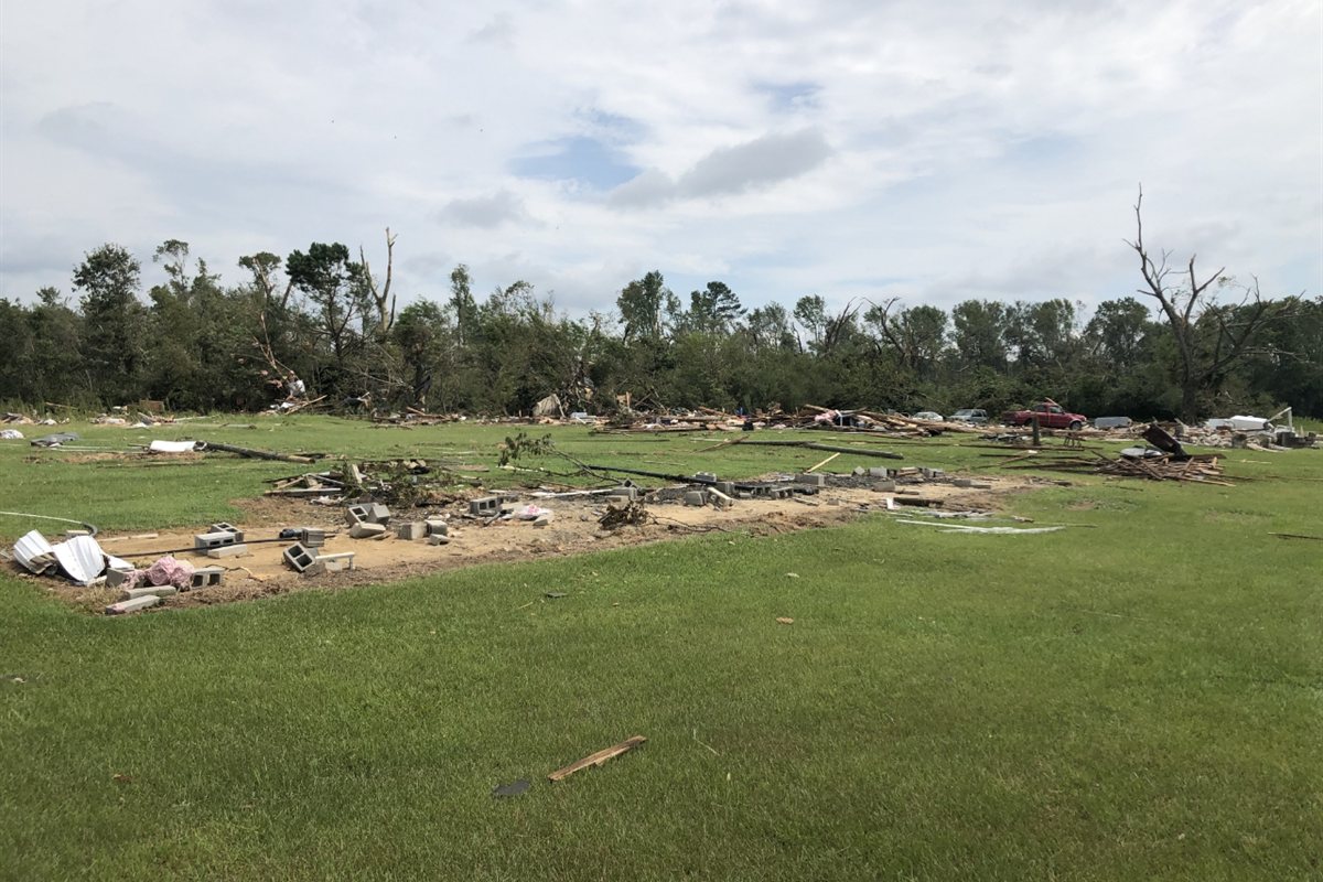
Even a "weak" Category 1 storm can do serious harm. Wind is only part of the danger. Flooding, storm surge and tornadoes often cause more damage than the wind itself.
Could it happen here in East Africa?
It is rare, but yes. Our part of the Indian Ocean does get cyclones, which are the same storm with a different name. Most of them stay out at sea or hit Madagascar and Mozambique, because Tanzania sits quite close to the equator, where the Earth's spin is weak (remember ingredient 4).
But in May 2024, Cyclone Hidaya reached our coast. It made landfall near Kilindoni on Mafia Island as a weakening tropical storm, one of only a handful of tropical cyclones ever recorded hitting Tanzania. At least five people died in Tanzania and more than 1,500 houses were damaged or destroyed. As our oceans grow warmer, it pays to understand these storms and to take warnings from the Tanzania Meteorological Authority (TMA) seriously.
Why this matters even if you live far away
A storm in the Gulf of Mexico can still reach your wallet. When Isaias forced companies to stop a large share of Gulf oil production, it showed how one storm can affect fuel supply, shipping and prices around the world. Good business owners plan for risks like this. Keep some savings for emergencies, avoid depending on a single supplier, and protect important documents and data.
5 simple ways to stay safe in a storm
- Listen to official warnings on radio, TV or your phone, and leave early if you are told to.
- Prepare a small emergency kit with drinking water, food, a torch, a charged phone and power bank, medicine and copies of your ID.
- Move away from the shore and rivers. Water, not wind, causes most storm deaths.
- Stay inside, away from windows, until the authorities say it is safe. If the eye passes over, the calm is temporary and the wind will return from the other side.
- Never walk or drive through floodwater. Just 30 cm of moving water can sweep away a car.
Frequently asked questions
What causes a hurricane?
Five things working together: warm sea water (at least 26.5 °C), warm moist air rising, air rushing in to replace it, the Earth's spin turning it into a spiral, and calm winds high in the sky that let the storm grow.
What is the difference between a hurricane, a cyclone and a typhoon?
Nothing except the name. It is called a hurricane near America, a typhoon near East Asia, and a cyclone in the Indian Ocean, including East Africa.
Why is the eye of a hurricane calm?
In the centre, some air sinks instead of rising. Sinking air dries out, so the clouds clear and the wind drops. The worst winds are in the eyewall right around it.
Why are there two hurricanes named Isaias?
Atlantic storm names are reused every six years unless a storm is so destructive that its name is retired. Isaias (2020) was not retired, so the name returned in 2026.
Do cyclones ever hit Tanzania?
Rarely. The most recent was Cyclone Hidaya, which reached Mafia Island in May 2024.
Keep reading
- The 30-Day Money Reset: build an emergency fund in 4 weeks
- More articles from the Wellbiz Solutions blog
Sources: US National Hurricane Center (NOAA), NASA, US National Weather Service, Wikipedia. Images are public domain. This article is for general education. In an emergency, always follow official instructions from your local authorities.
Join the conversation